

The WI standing over the Philly Brook, Chelmsford Road, Leytonstone
Sunday morning I led the newly-formed Leytonstone Women’s Institute (WI) on a walk along the course of Leyton and Leytonstone’s buried stream The Philly Brook (or Fillebrook or indeed Fille Brook – in fact spell it however you like).
I last did this walk in almost 4 years ago to the day with Nick Papadimitriou and David Boote for an episode of Ventures and Adventures in Topography.

Me and the WI on the course of the Philly Brook at the end of Newport Road
It was great to revisit the route in its entirety rather than my homages over the street iron in Southwest Road where the brook flows fast and loud all year round but is precariously placed on a bend in the road that seems to encourage wreckless driving.
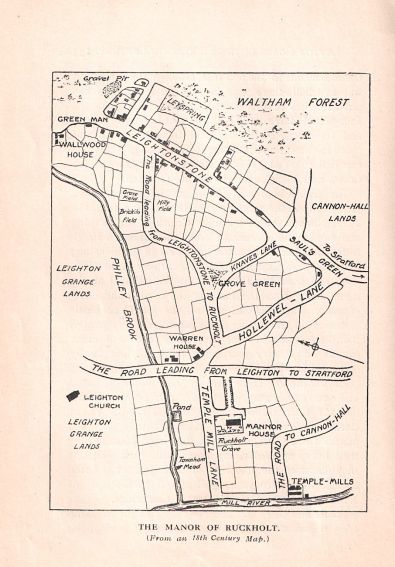
From The Story of Leyton and Leytonstone by W.H Weston (1921)
In the morning sunshine the brook was just visible some 20 feet down beneath the road – rushing on its way to meet the Lead Mill Stream beneath the mini-rounabout on Orient Way.
There we leant over to peer through the allotment fence to spy our precious watercourse briefly appearing above ground in a concrete culvert before disappearing once more beneath the tarmac.
What a great walk – not only was it informative but we WI members all became quite fond of our little ‘lost’ river over the course of the morning!
We had an Acme house on Fillebrook Road in the 1980s (now it’s under the A12) and common grazing cows in the garden but I never knew about the Philley Brook but the cows probably did.
Pingback: Blowing out the cobwebs - Leyton Loop via Hackney Marsh and Whipps Cross - the lost byway