Spring on Wanstead Flats

Tested out an old Olympus Zuiko OM 50mm lens on my Panasonic GH3 camera at the weekend over on Wanstead Flats. After a long hibernation you can see Spring starting to visit the Flats.

P1010037

I wish I was better at identifying wildflowers – I’ve sat here with 3 wildflower books on my desk, looked at 4 websites and I still can’t identify this beautiful little plant that was growing along the avenue that once led from Leytonstone High Road to the gates of the grand Wanstead House.

I show this picture to my 80-year father who instantly identifies it as Blackthorn. A Druid website says that in plant lore, “The Blackthorn tree is esoterically known as both the Mother of the Woods and the Dark Crone of the Woods.” And is also said to have, “the most sinister reputation in Celtic tree lore” associated with “ill omens” and to witches represents “the dark side of the Craft”.

P1010062

I’m going to stick my neck out here and say this is a gorse bush but with the caveat that I could be wrong and they merely look like a gorse to the untrained eye.

P1010054

P1010035

P1010016

Forest to the Lea Valley – walking video diary and ‘psychogeographical sound sandwich’

Here’s a video of the walk I did last weekend from Leytonstone to Ponders End. I’ve collaged a soundtrack from some old records, field recordings I made on my phone and some music I quickly knocked up on my laptop using Garageband – it more accurately reflects what’s going on in my head as I walk. Bob and Roberta Smith talked of creating a ‘sound sandwich’ when I interviewed him at the Barbican during the Cultural Olympiad where he was performing with his Apathy Band, and he related the idea, using lots of overlapping records playing, to the psychogeographical walks I was undertaking – but in audio form – a ‘psychogeographical sound sandwich’.

Eric Simms BBC

Eric Simms

The first ‘found sound’ on the video is from a gem of a record in the BBC Wildlife Series featuring recordings of birdsong made by Eric Simms originally broadcast on the Radio 4 Countryside programme. It’s a selection of Spring choruses – ‘a busy rookery’ recorded in Sussex, 1960. In the sleeve notes Simms writes, “For me perhaps the quickest way to evoke memories of places is to listen to recordings that I have made of their background sounds”. For me when I walk the sounds of the present are mingled with sounds, voices and memories of other places.

There was a serendipitous moment when I grabbed a bit of a recording of ‘If It Wasn’t for the ‘Ouses-In-Between’ performed by John Foreman when I just happened to skip to the lines:

Oh! it really is a wery pretty garden
And Chingford to the Eastward could be seen
Wiv a ladder and some glasses
You could see to ‘Ackney Marshes
If it wasn’t for the ‘ouses in between

Which is a fairly accurate description of the view from the footbridge over the North Circular between Walthamstow and Woodford, except the song was talking about the overcrowded East End of the 1890s, harking back to some rural idyll just beyond the rooftops. Is this what draws me out into the forest?


Read the blog post about this walk here

Walk from Leytonstone to Ponders End

IMG_5333

The urge was to walk without any particular destination and let my feet decide which way to go. They pulled me in a familiar direction – up Wallwood Road and past the Hindu temple to the Hollow Ponds. The merest drop of rain turns Leyton Flats into a bog and a crow paddled in a large pool of rainwater.

IMG_5337

Rooks decorated the bare boughs making rook sounds (is it a Corr or a Raww) gathering for their late afternoon parliament. I can only distinguish the rooks from the crows by remembering my Dad saying ‘A rook on its own is a crow’.

IMG_5351
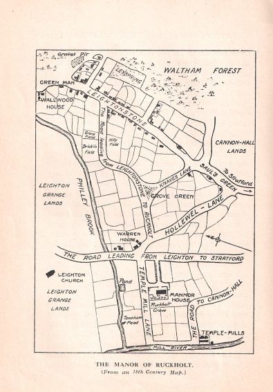
A rust coloured rivulet trickled near the overflowing Birch Well leading to/from the Eagle Pond, this area is cross-stitched with a tapestry of nameless seasonal ditches and brooks.

IMG_5359
RS Lounge is looking rather sorry for itself these days – I black bin-liner was wrapped around its once glowing neon sign fluttering in the wind like a harbinger of doom. RS was built on the site of the Rising Sun pub which dated back to at least the 1850’s before the £2million refurb that transformed it into an Ibiza style luxury bar and dining thing.

IMG_5384
The thwack of tyres over the cattle grid scares the wildfowl from the pond. The footbridge crossing the North Circular offers one of my favourite views of London a north-western slice across the Lea Valley, tall chimneys spewing out fumes, the tower blocks in the distance set at angles I suppose to maximise sunlight. It’s an expansive, varied vista, industrial London, broad freeways, a carpet of housing, the river, reservoirs, the forest, green plains, hills on the horizon.

IMG_5395
I pick up a stick to help steady my progress through the ankle deep mud. I skit between the path and the undergrowth not so much walking to Woodford as sliding and skating, with my stick and greying beard I feel like Gandalf on Ice.


The Ching gurgles blissfully between steep river banks as it slips round the edge of the lake at Highams Park. Now I have my sights set on Chingford Green – a place that seems incongruous in modern London, like one of those out-of-place artifacts that defy the conventional understanding of human history. I leave the forest sludge and rest my trusty staff against a bench by the pavement and ascend Friday Hill once I’ve acquired a Double Decker from the petrol station to fuel my climb.

IMG_5416

IMG_5418

Friday Hill House has the forlorn look of a place that was once loved but now abandoned and unwanted. Built in 1839 by Lewis Vulliamy for the Boothby-Heathcote family, they eventually sold it to the London County Council who constructed the Friday Hill Estate in the grounds and the house became a Community Centre and later an adult education college. Its fate now remains unclear.

IMG_5425

The Chingford United Services Club though appears to be thriving and the Seafood stall in the carpark had a short line of customers eager for cockles, winkles and crab. After admiring the ‘Second Empire’ architecture of The Bull and Crown coaching inn (now a branch of Prezzo) I retire to Sams ‘quality fish and chips restaurant’ – notice the ‘chips’ in plural.

IMG_5431

IMG_5429

It’s not been the brightest of days and now 30mins before sunset it’s positively gloomy. I’m drawn along the path beside the parish church to the crest of Kings Head Hill and a close-up of the view I’d taken in earlier from the bridge across the North Circ. I keep plodding on, my destination reached but my feet aren’t ready to quit just yet.

IMG_5444

Halfway down the hill past Sunnyside Lodge and opposite a fine cottage-style electricity substation there is a brass plaque set in the pavement commemorating the 1986 Year of Peace. An odd place to celebrate an international event unless of course Chingford has a hidden link to the Baha’i Faith that seems to have instigated the event. Is the substation a temple pumping out peace around the world? Nothing would surprise me about Chingford.

IMG_5469

IMG_5458

Looking across the Lea Valley at sunset this corner of North East London always makes me think of America – open spaces, wide roads, car lots, Wim Wenders directing Paris Texas, David Lynch weirdness, possibility. The sodium lights of the industrial Lea Delta after a muted sunset. Pylons, sheep grazing on the grassy banks of the reservoir. A Harvester pub and restaurant which I would love to enter but my boots are caked in London Clay which has also splattered up my legs to my knees.

IMG_5479

Now I am bound for Ponders End in the dark. The tower blocks of the Alma Estate (Kestrel, Cormorant, Merlin and Curlew House) guide me in by the few lights still shining, with the estate slated for a £150 million regeneration scheme I guess they must have started to move tenants out.

IMG_5481

A Roundabout of Death tricks me to walking along the hard shoulder before doubling back to find my way to the Station – cars zipping past at speed heading for the desert, for Vegas, or more likely Waltham Abbey and Cheshunt. My feet led me well on this walk – I should trust them more often.


Thousands March for Homes in London

Yesterday saw thousands of people take to the streets of London in the March for Homes. This builds on recent high profile housing campaigns such as Focus E15, the New Era Estate, and Our West Hendon. But this is just the tip of the iceberg, as one campaigner from Feminist Fightback told me there are 70 social housing estates undergoing ‘regeneration’ which is often just a means of demolishing the existing homes, displacing the tenants and privatising some if not all of the land. The group has calculated that there are around 160,000 tenants facing eviction and/or rehousing. The land value of these 70 estates is estimated to be in the region of £52billion.

Fred & John Towers banner

There was a great spirit amongst the diverse range of Londoners traipsing through the rain from the congregation points of St Leonard’s Church Shoreditch and the Elephant and Castle – converging on City Hall, Boris Johnson’s Death Star. A lady thrust a yellow flier into my hand whilst I stood on a peddle-dash plinth trying to get a decent shot of the procession from a higher vantage point. ‘Fred & John Towers Not For Sale’ – Leytonstone’s own iconic tower blocks beside Wanstead Flats that played host to snipers and anti-aircraft missiles during the London Olympics. The E15 Campaigners have joined forces to help the residents who face being rehoused while Waltham Forest Council sell off one of the blocks and dispose of 70 Council homes in the process.

Fred and John Towers Leytonstone

Next week the residents of Earls Court will be demonstrating to save the heart being ripped out of their area with a £8billion development. New battle lines are being drawn all across London every day in the fight for the soul and the future of this great ancient city.


Walk along the Philly Brook (Fillebrook) with the Leytonstone WI

Leytonstone WI

The WI standing over the Philly Brook, Chelmsford Road, Leytonstone

Sunday morning I led the newly-formed Leytonstone Women’s Institute (WI) on a walk along the course of Leyton and Leytonstone’s buried stream The Philly Brook (or Fillebrook or indeed Fille Brook – in fact spell it however you like).

I last did this walk in almost 4 years ago to the day with Nick Papadimitriou and David Boote for an episode of Ventures and Adventures in Topography.

Leytonstone WI walk

Me and the WI on the course of the Philly Brook at the end of Newport Road

It was great to revisit the route in its entirety rather than my homages over the street iron in Southwest Road where the brook flows fast and loud all year round but is precariously placed on a bend in the road that seems to encourage wreckless driving.

Philly Brook map

From The Story of Leyton and Leytonstone by W.H Weston (1921)

In the morning sunshine the brook was just visible some 20 feet down beneath the road – rushing on its way to meet the Lead Mill Stream beneath the mini-rounabout on Orient Way.

There we leant over to peer through the allotment fence to spy our precious watercourse briefly appearing above ground in a concrete culvert before disappearing once more beneath the tarmac.

Damon Albarn unveils his Blue Plaque in Leytonstone

This morning Blur crooner and Gorillaz cartoon frontman, Damon Albarn returned to the house in Fillebrook Road, Leytonstone where he lived till he was 10 to unveil a Blue Plaque.

IMG_8781

Albarn referenced Leytonstone in his recent album, Everyday Robots, most notably with the track Hollow Ponds.

IMG_8803

He also returned to the area to perform surprise gigs at Leytonstone Library and the The Red Lion.

IMG_8808

The Albarn Family – Damon’s Dad, Keith Albarn was a notable artist in the 1960’s and 70’s.


IMG_8831

Damon reminisced about seeing herds of cows wandering along Fillebrook Road on their way to graze on Wanstead Flats.

IMG_8780

He offered to support the Save the Heathcote campaign, his Dad having frequented the pub in his Leytonstone years.

Damon Albarn blue plaque Leytonstone


Borderlands – a walk around the boundary of Leytonstone

Leytonstone Council Wards

Leytonstone Council Wards

I’d been wanting to walk around the border of Leytonstone for some time – the major obstacle being working out exactly where Leytonstone ended and Leyton/Stratford/Forest Gate/Walthamstow/Wanstead began. Walking around the E11 postcode district wouldn’t work as a big chunk of it is Wanstead and Snaresbrook in the borough of Redbridge. There’s also the potential anomaly that Leyton tube station is in E11 so did that mean it was Leytonstone? Council ward boundaries weren’t much help as they crossed over into areas that are definitely in other parts of the borough. Andrew Stevens suggested using early administrative boundaries for sewage and water works and although it threw up some interesting nuggets didn’t fully solve the conundrum.  I rang the Council who were helpful but concluded that Leytonstone had no recognized boundary.

In the end I sketched out a route using the E11 postcode where it was in Waltham Forest, the areas containing a borough boundary where it couldn’t be anywhere but Leytonstone (see later for where this occurs and falls apart) and added areas that are commonly agreed to be landmarks of Leytonstone – e.g. Whipps Cross, Hollow Ponds, Thatched House, St. Patrick’s Cemetery. That gave a fairly reliable start point and only left a few grey areas that would have to be tested on foot. Although I’ve lived in Leytonstone over 8 years now and walked most streets in the area I couldn’t feel I truly understood where I lived until I’d stalked the entire perimeter in a single perambulation; sticking doggedly to my turf, looking out beyond as much as in.

Newport Road to Whipps Cross

I met Andrew and his son on the corner of Norlington Road (E10) and Newport Road (my brood bailed early on for Abbots Park, Leyton). One side of Newport is apparently in Leytonstone with the other allegedly in Leyton (Jersey Road being the exception where E11 crosses sides). This is a low point in the ground where the Fillebrook gurgles beneath the tarmac through what would once have been open fields and could have been used as a boundary although unlikely as it seems to have cut through one parcel of farmland or estate. From here we followed the blue postcode line on my Knowledge map taking us round Pretoria Road then surprising goes the length of Norlington Road on the school side then loops round to take in the end of Hainault Road E11 where it meets Leyton High Road.

Turning off Hainault Road we would have needed to leap across garage roofs to stick rigidly to the boundary so we took a 20 yard detour into Leyton to pick up the end of James Lane. It was a straight run along the backs of garages – easily imaginable as an old laneway or cart-track when the area was rural. We then turned along Peterborough Road which I’d always assumed was Leyton but it’s marked E11 and the alternative would be to go through the grounds of Whipps Cross Hospital and miss out a small section of roads on the far side. Skirting round the edge of Whipps looking across at the boarded up nurses accommodation block we kept tight to the Leytonstone border through a tidy nest of streets containing a mysterious abandoned-looking Hansel and Gretel cottage coming out onto the small green at Whipps Cross Roundabout where the trams once stopped. What the people of Leytonstone wouldn’t give to revive the old tramlines from here into Whitechapel.

Whipps Cross to the Birch Well

The border skirts the edge of the Whipps Cross Roundabout in a curious corner where Leytonstone, Leyton and Walthamstow meet and exchange harsh words, sledging each other across the road. This leads up to one of Leytonstone’s oddities – the row of Victorian houses beside the patch of open land with pond known as The Forest. First time I stumbled across this isolated settlement I was sure there had to be a pub to round off the image of the perfect village green but all I found was the expensive Forest private school.
Here we had to rely on the borough boundary separating Waltham Forest from Redbridge that cuts through the forest keeping tight to one edge of the Eagle Pond and behind Snaresbrook Crown Court. Here in the trees Andrew’s son spotted a small pool covered in a mat of luminous green algae. It looked like a well with carved stone edging and water around 2 feet deep. I posted the photo on Facebook and within 30 minutes had been told exactly what it was and its history. Philip and Richard responded with both descriptions and sketch maps confirming that this was The Birch Well – an “important source of water” at during times of drought and water shortages.

Leyton Flats to Bushwood

We clambered over an ivy-covered wall so Andrew could show me the ruin of the Chaplainry from the time when the law courts were an orphanage (Andrew wrote a piece on it for 3:AM). Following a dried up ditch that I speculated could be the course of the River Holt we emerged on Holy Bush Hill and walked down to the holiest of holy Leytonstone relics – the High Stone. Although it’s been moved a couple of times over the years this marks one corner of the area – everything around it is Redbridge.
Under the Green Man roundabout and rest-bite in the North Star which is blissfully close to the Bushwood border. There’d been a Leytonstone Jumble Trail that day and a few houses on Bushwood still had scattered items in their front gardens. Across the road from here is neither Redbridge nor Newham but the Corporation of London (get your head round that – although nowhere near as confusing as when you run into the Corporation livery when going for a stroll in Burnham Beaches, Bucks).

Wanstead Flats to Thatched House

We skirted the edge of Wanstead Flats by the iconic Fred Wigg and John Walsh towers and payed homage to the fine Metropolitan Cattle Trough, coming out through the trees onto Harrow Road. As we passed the end of Cann Hall Road headed for the E7 section of Waltham Forest Andrew refused to go further on the solid grounds that ‘no one in their right mind would say that this was Leytonstone’. Fair point. But there is a block of streets from Cann Hall (recognized Leytonstone E11) to Vansittart Road round the edge of West Ham cemetery onto Leytonstone High Road via Janson Road that sit within the boundary of Waltham Forest and surely couldn’t be in Leyton. Andrew argued that simply part of Forest Gate must be in both Newham and Waltham Forest. I did wonder whether he was just tired and fancied cutting a chunk off the walk,  however Cann Hall Road did make more sense.
I’m still raw from the closure of my precious local The Heathcote Arms so walking past the boarded up Lord Rookwood and The Colegrave Arms converted to a mosque, both on Cann Hall Road, topped off by the Thatched House invaded by a bookies, opposite the junction with the High Road, was like a macabre exhibition of the fate that befalls pubs once sold. Let’s hope not eh.

Crownfield Road to the Link Road

While Crownfield Road, E15 seems like a natural border a few small streets to the south appear to be in Waltham Forest. We couldn’t decide at which point Crownfield Road became Leyton and the idea that Leyton High Road was on the border seemed mad so we made an arbitrary turning off Crownfield up Ellingham Road into Downsell Road (the school here is listed as Leytonstone) heading for Langthorne Road – undeniably Leytonstone and taking us past the old Infirmary, St Patrick’s Cemetery (which has Leytonstone on the plaque by the entrance), and the legendary Birkbeck Tavern – a pub saved from being zombied into flats.
There are a series of streets leading down to Leyton High Road here that are in E11 and could be claimed for Leytonstone but it’s unlikely anyone living there, so close to Leyton tube would refer to this as Leytonstone (Leslie Rd, Millais, Frith, Calderon, Webster, Goodall) – but we could well be wrong. After writing off the E7 parts of the borough we were becoming gung ho with our judgments and had no problem dispatching a block of E11. On reflection I think this might have been a mistake.

Grove Green Road back to Newport via Twickenham Road

From here it was fairly straightforward to cross the Link Road via the foot-tunnel, up Grove Green Road, along Francis Road, into Twickenham, St. Anne’s (half of which is Leyton) and up Newport on the eastern side with a detour round Jersey Road E11, to close the loop by Dennis’s shop. In total took us around 4 hours to cover approximately 8 miles.